|
Photos of Virgin HABlantic – First Flight
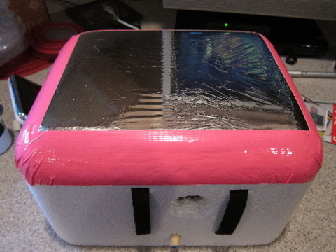
The payload during the build
|
|
|
|
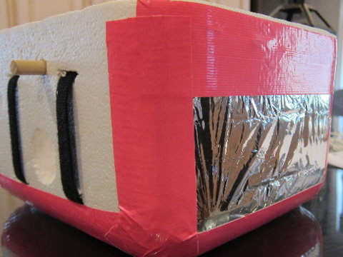
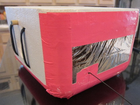
The bottom of the payload.
|
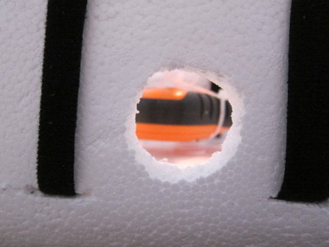
Simple camera ports for the lens to extend out.
|
|
|
|
|
Here are side views with rubber duck antenna sticking out of the side. We used a simple mylar blanket duct taped to the sides and bottom
to provide a reflective surface as a test to see if it would reflect radar for tracking through the local air traffic control tower.
Within a few hundred feet of the launch it was detected. It was much cheaper and lighter than a formal radar reflector.
|
|
|
|
|
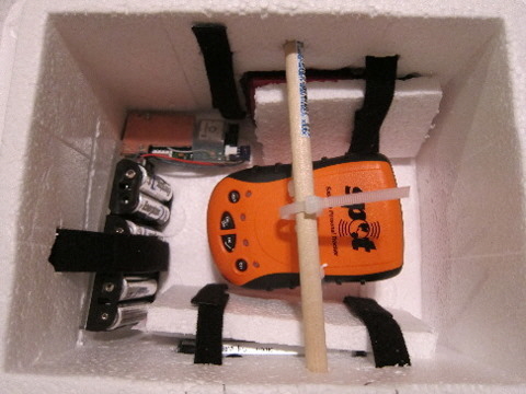
The inside of our payload you can see cameras mounted as well
as 2M gps transponder and battery pack. Before launch we did
add handwarmers between the Styrofoam and the camera.
|
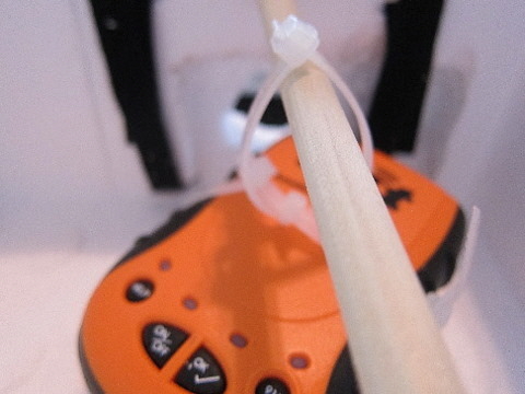
I tried to build a gimbal for our spot to sit on so that it would
always remain facing up, but I had a really hard time making this
work correctly. So I came up with this suspended design
on a dowel. Testing at home showed the spot would send
messages no matter how the payload landed
|
|
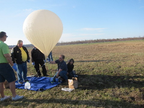
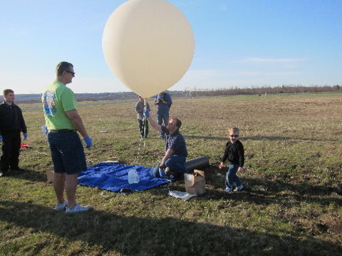
Getting the payload ready and inflating the balloon
|
|
|
|
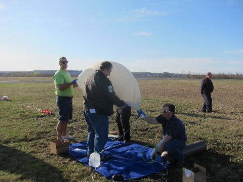
Got my tarp, tank, parachute, and payload laid out, inflating balloon
slowly; it was helpful having extra hands with latex gloves.
|
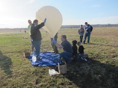
Balloon getting fuller, but still at risk for bouncing around
in the wind and getting damaged.
|
|
|
|
|
Now balloon is floating. I have line attached to neck lift ballast
(water jug) with another line tied from the water to the tank
so it doesn’t float away accidentally.
|
Balloon is just about inflated enough with ballast
barely lifting off of the ground.
|
|
|
|
|
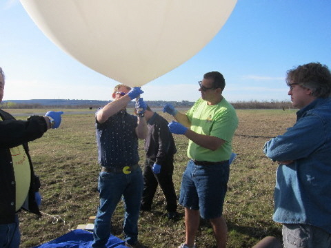
Tying was probably the most dangerous part of the of the whole day.
I decided to use thick rubber bands with a loop twist loop design
at the top of the neck and then at the bottom of the neck.
We then folded the neck over the loop in the rope for the payload
and the neck and electrical taped the whole thing.
|
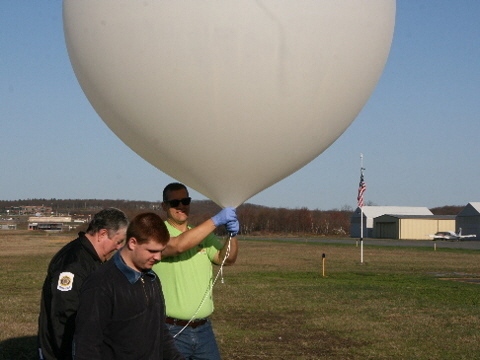
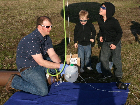
Tom was the point man for holding the balloon from taking off
while I fiddled around with my cameras. He got a workout
holding onto that balloon.
|
|
|
|
|
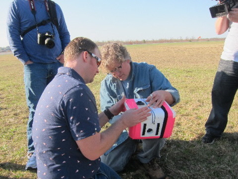
Robert Stetz helping me do a last minute payload check.
|
Nice to see my boys taking an interest.
|
|
Beginning the launch
|
|
|
|
First pic from cameras after liftoff, facing Hazleton.
|
Launch!
|
|
|
|
|
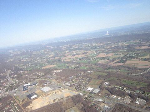
We can see the bottom of the runway of Hazleton Municipal Airport
at the bottom center of the pic. Center is the valley with
Susquehanna Nuclear Power plant in the distance.
Remember the steam coming out of the power plant
as it helps in future pics.
|
Looking north we again see the airport at the bottom of the pic with Interstate 81 slicing through the center and the powerplant in the back.
|
|
On the way up... our hometown from above
|
|
|
|
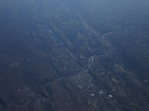
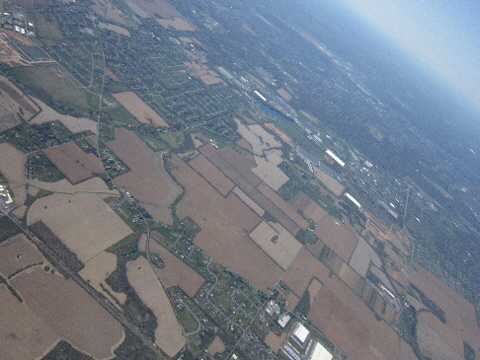
Great view of greater Hazleton area with the city in the center;
Humbolt Industrial Park is in the upper left. Again we can see
the nuke plant on the right side.
|
Another nice Hazleton pic.
|
|
|
|
|
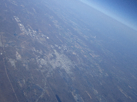
Now we are getting up there. This shot is taken close to 100,000 feet.
We can see Hazleton in the left center; in the upper right we can see
the Wyoming valley. The Lehigh river is carving through the bottom
of the pic. Again we can see the nuke plant above Hazleton.
|
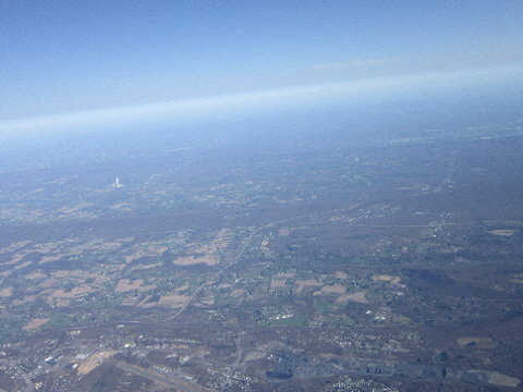
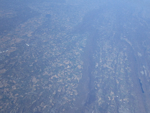
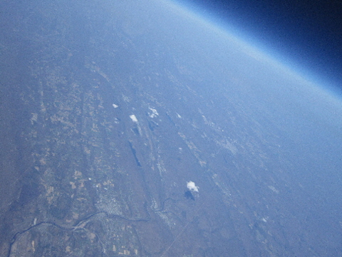
At an altitude of 80 to 90,000 feet we see the Blue Mountain
running through the center of this pic. Lake Mauch Chunk
can be seen on the right.
|
|
Getting higher
|
|
|
|
|
|
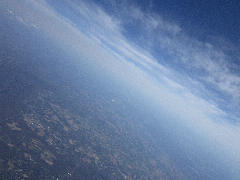
Nice views at upper atmosphere clouds and some jet contrails; probably around 70,000 feet.
|
|
|
|
|
|
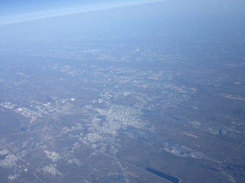
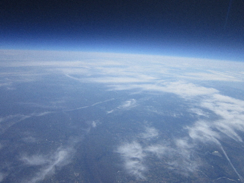
Here we can see the Lehigh River with Jim Thorpe in the center bottom.
You can also see Hazleton in the upper right as well as the tiny spike
of smoke coming from the nuke plant! Nearing 80,000-90,000 feet.
|
Closer view of the Lehigh carving through the mountains
with Lake Mauch Chunk.
|
|
|
|
|
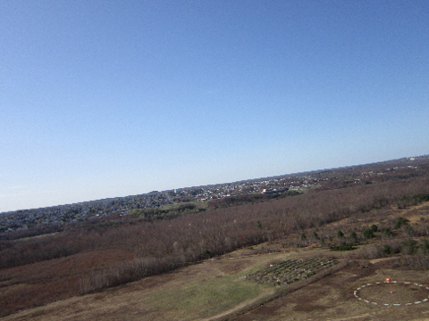
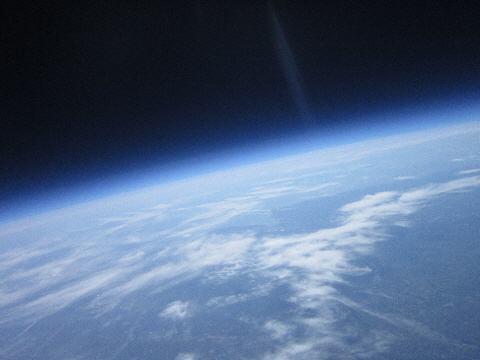
Lehigh Valley from over 100,000 feet.
|
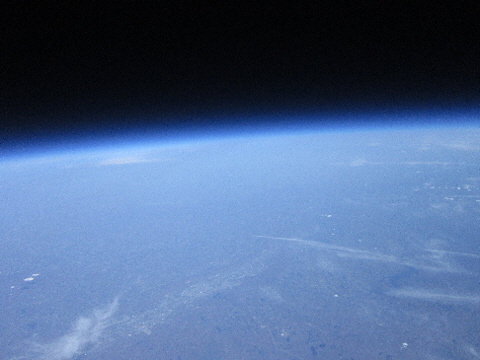
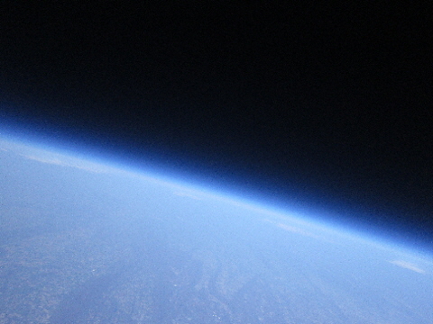
Pointing northwest, we see Hazleton in the bottom left
with the Susquehanna River just below the nuke plant.
Great perspective with the earth’s curvature with the blue
of our atmosphere and the black of space.
|
|
|
|
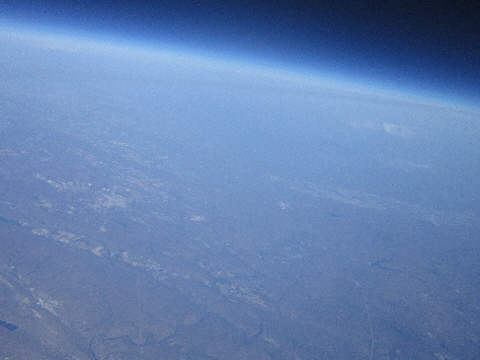
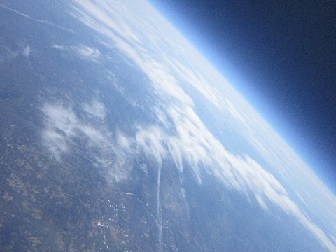
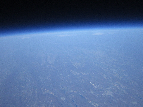
Great shot of our earth’s curvature with the black of space.
This was taken close to 106,000 feet.
|
|
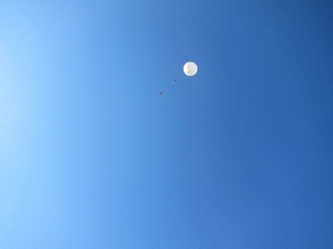
Landing and touchdown
|
|
|
Coming down...
|
|
|
|
|
Coming down, landing zone in sight.
|
Just a few seconds before touchdown.
|
|
|
|
|
We are in the dirt. This camera lasted for about 5 minutes after landing.
|
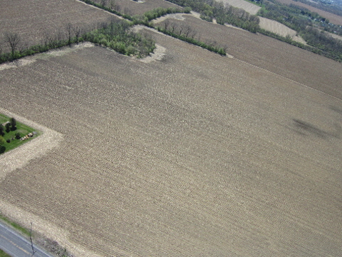
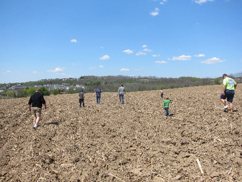
Search team out to retrieve payload in a freshly plowed corn field.
Best possible landing area.
|
|
Recovery crew
|
|
|
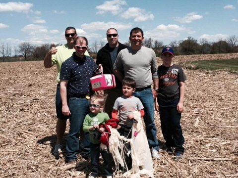
Here we are with a successful recovery by the chase team.
In back (L-R), Dr. Tom Kislan (thumb up), Phil Benyo (holding payload),
Shawn Gallagher, Kit Danzeisen and his son, Kittrick.
In the front (L-R) are my two boys, Jack and Philip.
My wife Maria is holding the camera.
|
|
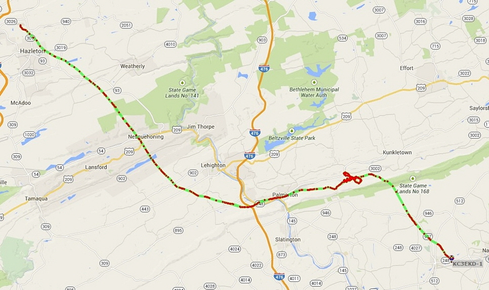
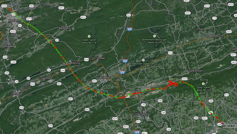
Mapping and sattrack
|
|
|
|
|
|
|
The track the balloon took, with each red dot representing a radio transmission.
|
|
Interactive map
|
|
|
3D view of how the launch went and how high. Pretty cool view.
CLICK HERE
|
|
Home | Launch 1 | Launch 2 | News & Updates | Photos | Resources | Contact Us
© Anthracite High Altitude Ballooning. All rights reserved.
|